Donate to WeatherGraphy™

Monday, July 20, 2020

Strong to Severe Thunderstorms This Afternoon, Flood Watch.

The Storm Prediction Center has upgraded portions of Western and Central Kentucky into a Slight Risk for severe weather this afternoon.

There is no tornado threat today for Kentucky's strong to severe thunderstorms this afternoon.

Here is the damaging wind threat, 15 percent in yellow.

Here is the hail threat, 5 percent brown.


Flood Watch in effect 
(Dark Green)


Flash Flood Watch for portions of central Kentucky

* Until 2 AM EDT /1 AM CDT/ Tuesday

* A slow-moving boundary along the Ohio River has helped spark a line of showers and storms across north central Kentucky. Storms will be capable of producing torrential rainfall with rainfall totals of 1 to 3 inches possible, leading to potential for localized flash flooding issues in some areas.

A Flash Flood Watch means that conditions may develop that lead to flash flooding. Flash flooding is a very dangerous situation.

You should monitor later forecasts and be prepared to take action should Flash Flood Warnings be issued.

Friday, July 10, 2020

Strong to Severe Tstorms Late Tonight & Sunday

For today

An Enhanced Risk has been issued for portions of Oklahoma, Kansas, Missouri, and Arkansas.

Slight Risk for a good portion of Kentucky.


Here is the tornado threat in two percent 


Here is the damaging wind threat 
30% red, 15% yellow, and 5% brown.


Hatched Significant hail threat 30% in red for potions of Oklahoma, Kansas, and Missouri.


For Sunday


Scattered strong to severe thunderstorms will be possible on sunday throughout the Ohio Valley region.

A marginal risk has been issued by the Storm Prediction Center. Below is the categorical outlook for sunday.


Here are the probabilities which are quite low at the moment with a 2% chance for an isolated tornado.


Here is the damaging wind threat.

Lastly, here is the hail threat


Saturday, June 27, 2020

Flash Flood Watch, Severe Weather Sunday

Weather.gov

 
Flash Flood Watch


FLASH FLOOD WATCH IN EFFECT THROUGH MONDAY MORNING...

The National Weather Service in Louisville has issued a

* Flash Flood Watch for portions of Indiana and Kentucky, including the following areas, in Indiana, Perry. In Kentucky, Adair, Boyle, Breckinridge, Bullitt, Butler, Casey, Edmonson, Garrard, Grayson, Green, Hancock, Hardin, Hart, Larue, Lincoln, Madison, Marion, Meade, Mercer, Nelson, Ohio, Russell, Taylor, and Washington.

* Through Monday morning

* A stationary boundary over the region tonight will combine with a tropical airmass to bring some heavy rainfall to the region tonight and continuing into early Monday. Multiple waves of storms will bring area rainfall totals of one to three inches in the flood watch area, but localized amounts of five inches are possible through Monday morning.

A Flash Flood Watch means that conditions may develop that lead to flash flooding. Flash flooding is a very dangerous situation.

You should monitor later forecasts and be prepared to take action should Flash Flood Warnings be issued.


Strong to Severe Storms

The National Weather Service Storm Prediction Center has upgraded portions or Kentucky into a Slight Risk for severe weather tomorrow. Strong to severe Convection may be ongoing in the morning and then clearing out later. During the afternoon and evening hours, additional strong to severe thunderstorms will be possible mainly across Central and Eastern Kentucky.

Here is a low, but non zero tornado threat
5 percent in brown, and 2 percent in green. 

For Kentucky, the chance for a brief tornado will be during the afternoon and evening hours on Sunday.

Here is the wind threats; 15 percent Yellow, 5 percent in brown.

Here is the hail threat; 15 percent yellow and 5 percent brown.

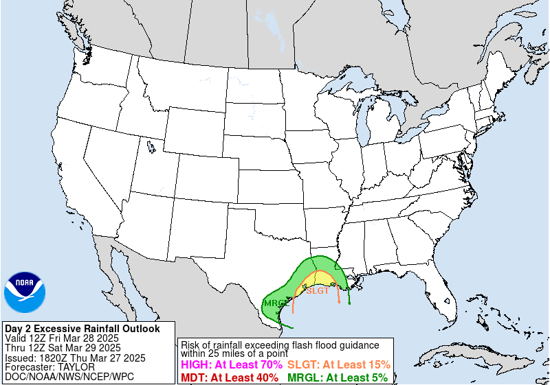
There is also a Slight Risk for flooding as some locations will see repeated rounds of thunderstorms on Saturday and Sunday.

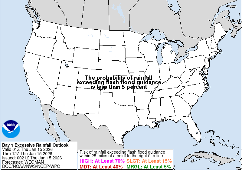
Today
Day 1 Excessive Rainfall Forecast

Sunday
Day 2 Excessive Rainfall Forecast


Air Quality Warning For Kentucky

Saharan Dust This Weekend 


AIR QUALITY WARNING FOR KENTUCKY IN EFFECT FOR SATURDAY AND SUNDAY... The Kentucky Department of Public Health has issued an Air Quality Warning for the state of Kentucky for Saturday and Sunday. A dust cloud blowing across the Atlantic Ocean from the Sahara Desert in Africa has been impacting air quality over the southern United States in recent days. Some of this dust will reach Kentucky this weekend resulting in poor air quality. Members of sensitive groups may experience health effects. The general public is not likely to be affected. Sensitive groups include the elderly...children...persons with asthma or other breathing problems...and persons with lung and heart disease. People in these groups are advised to limit their outdoor activities to reduce their exposure to particulate pollution. For more information, visit the following websites below http://chfs.ky.gov/dph https://kyemky.gov https://airnow.gov https://chfs.ky.gov/dph/Pages/default.aspx

Sunday, June 21, 2020

Marginal Risk KY. Enhanced Risk KS, OK, NE. Moderate Risk KS, OK

For Kentucky 
There is a Marginal Risk for strong to severe thunderstorms this afternoon and evening across Indiana, Ohio, Kentucky, and Tennessee. The main risk with these storms will be damaging winds, heavy rain and lightning.

For Kansas, Oklahoma and Surrounding
In the Moderate and Enhanced Risk Areas, severe thunderstorms are possible with all modes.


Tornado Threat 
2 percent chance in green, and 5 percent chance in brown for a tornado within 25 miles of a given location.


Damaging Wind Threat 
Damaging winds are possible in brown 5%,  and yellow 15% with the highest chance in the 45% pink, and 30% red circle in Kansas and Oklahoma.


Hail Threat 
Hatched Significant hail Threat for portions of Kansas and Oklahoma in pink and red. Elsewhere 15 percent yellow, and 5 percent brown.


The Tropics


Atlantic 


Eastern Pacific 


Be sure to stay up to date with the National Weather Service & National Hu Center.


Strong Storms moved through Central Kentucky this morning 


Here are pictures of the arcus cloud.


Wednesday, June 10, 2020

Severe Thunderstorm Watch #275

The National Weather Service has issued a severe thunderstorm watch for isolated severe thunderstorms this evening. This goes until 6:00 pm edt.

A Moderate Risk has been issued for Portions of Michigan, Ohio, and Extreme NE Illinois.

Tornado Potential remains low, damaging straight line winds are the main threats.

Hatched Significant wind Threat in Michigan. (PINK) Illinois and Ohio. (RED)

Hail threat


Tuesday, June 9, 2020

Cristobal Remnants to bring Strong to Severe Weather Today

Today

Remnants from Cristobal to bring scattered strong to severe thunderstorms to the Ohio Valley.

NHC Tropics

Here is the low, but not zero tornado threat. Brown is 5 percent and green is 2 percent. 

Here is the damaging wind threat, yellow is 15 percent, and brown is 5 percent.

Here is the hail threat, hatched significant in the black circled yellow 15 percent areas, brown is 5 percent.

https://us.shein.com/Drawstring-Waist-Hooded-Jacket-p-538706-cat-1735.html?scici=Search~~EditSearch~~1~~Jacket~~~~0~~0

Tomorrow